Geotechnical Site Investigation, Analysis and Design
CGL was commission by MACE to provide a geotechnical site investigation for the proposed redevelopment at Calverley Square, Tunbridge Wells. Locally complex geology demanded a phased SI approach, responding to an evolving design, construction demands and to meet defined programme requirements for MACE’s second stage tender, to ultimately de-risk key areas with regards to the dynamic ground and groundwater conditions.
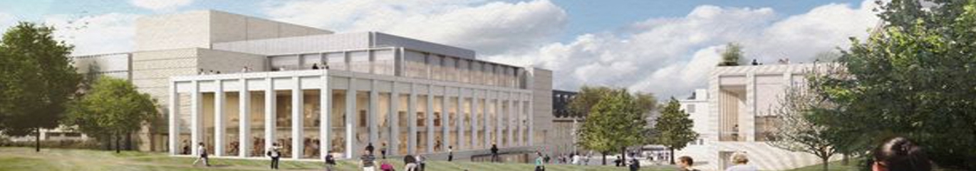
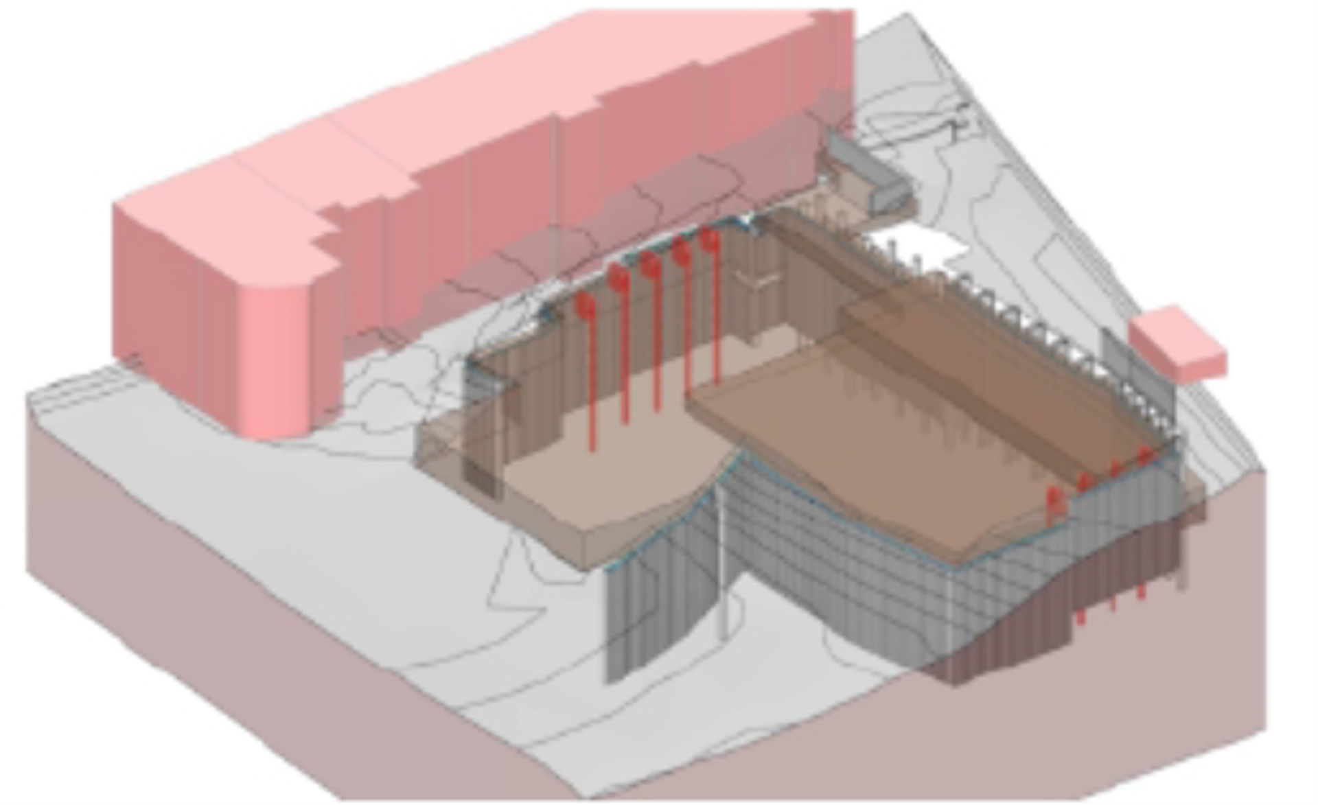
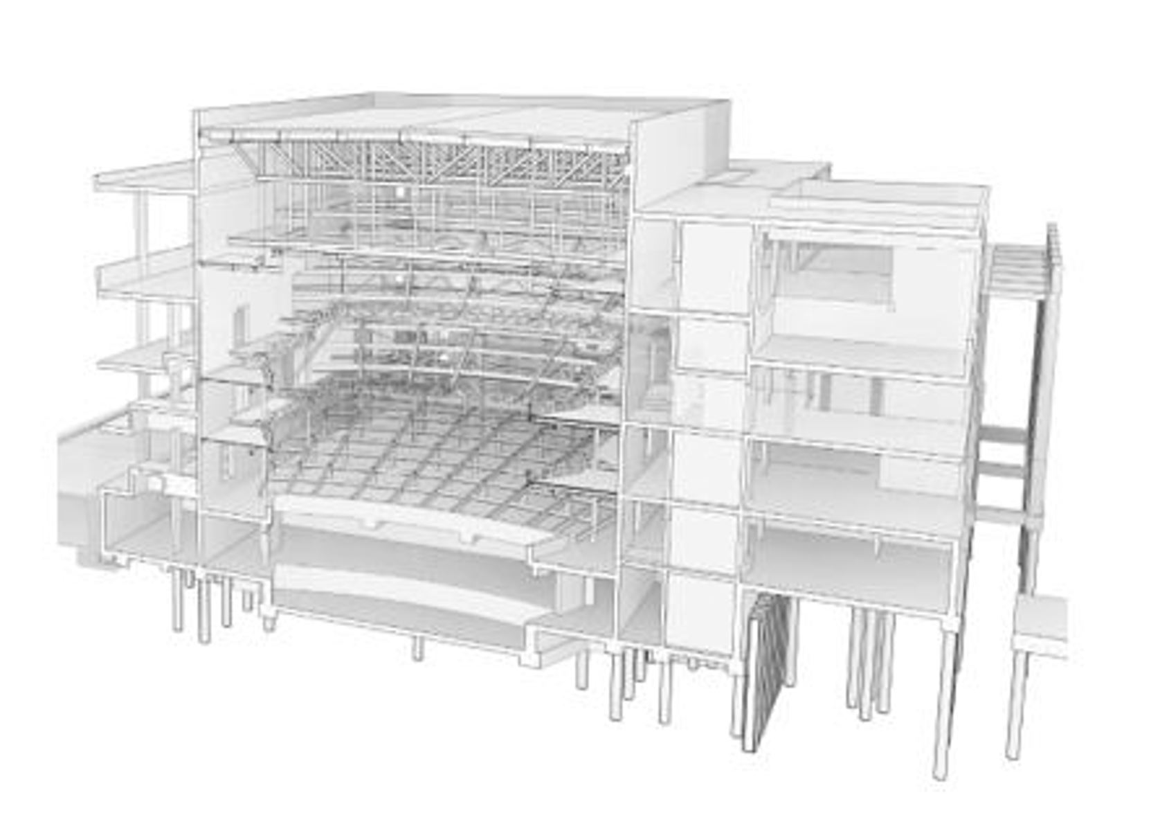
The development comprises of the demolition of the existing multi-storey and open-air car parks and the construction of a new theatre, office and civic centre with three to four basement levels in the northern and central areas of the site and an eight-storey theatre with single level basement in the south-western region.
The construction requires the excavation of around 5 to 12m to reach proposed formation level in the northern area, reducing to less than 3m in the southern region. The excavation was retained by a secant pile wall 11 to 20m long and a system of temporary and permanent buttress piles. Three tower cranes planned on the site were incorporated into the model together with a king post wall to allow for the basement excavation without damaging the neighbouring buildings, located 4m from the piled
wall.
Phase 1 ground investigations (GIs) provided data on ground and groundwater conditions targeting the proposed northern development, de-risked the potential northern fault zone and investigated the presence of potential relict periglacial shear surfaces and Head Deposits to inform temporary slope angles. The second GI phase targeted a historical war-time shelter location to assess contamination and to further de-risk this central-southern area. Finally, the third GI phase provided data on ground and fluctuating groundwater conditions, specifically targeting the southern theatre area, dissecting the Tunbridge Wells Fault line, where the existing basement box is to be deepened and reused.
Hydrogeological assessments and complex geotechnical design items followed, utilising the developed geological and geotechnical model and groundwater regime findings to de-risk key design aspects for the main contractors. Innovative Finite Element Modelling (FEM) software and PLAXIS 3D allowed for three-dimensional site-wide ground models to be produced to accurately and realistically model locally complex geological conditions, including a problematic fault zone. This data fed into live geotechnical and temporary works designs, including a complex and dynamic 3D hydrogeological risk assessment, using LIDAR (light detection and ranging) data to de-risk the groundwater impact to the basement retaining wall.
The development of a detailed geological model and hydrogeological model informed from the phased GI was invaluable in the preceding dynamic geotechnical and temporary works design offering the Client a cost-effective, pragmatic, programme orientated, and a safe working solution compared to conventional methods.